Kilimanjaro National Park
Projects
Name: Kilimanjaro
Origin of the name: The precise origin is not yet well known. Possibly it originated from a misspelling of a Chagga name “Kilemajyaro” which means the impossible hill/mountain to defeat or from “Kilimanjaro”
Loosely translated as the mountain of greatness or whiteness.
Location: Kilimanjaro region, 330Km south of the equator.
Year of establishment: 1974 and 2005
Size: 1,668Km2
Altitude from the sea level: ranges from 1800m to Kibo summit 5895m
Distance: 123Km from Arusha in 2 hrs drive, 86Km from KIA in 1½ hours drive, and 48Km from Moshi
town in 1hr drive. The main headquarters at Marangu gate.
Geographical features/Landscape:
- The highest free-standing mountain with 2 dormant peaks, Kibo (5895m) and Mawenzi (5149m)
and one extinct peak of Shira (3962m).
- The natural wonder of Africa (2013)
Main attractions:
- Kibo peak covered by snow throughout the year offering an adventure of a lifetime.
- Mawenzi peak which is rugged peak, only accessible by technical skilled and specialized climbers
- Shira peak, the oldest peak which collapsed some 750 years ago while it was the highest peak
before the collapse.
- Cathedral point at Shira peak offering a day hike to the summit
- Shira Plateau formed after the collapse with the scenic beauty of open grassland of heath, moorland
(lobelias and senecio)
- Shira Central cone
- Montane forest (dense lush forest) stretching around 1800m to 2800m which provides 96% water
source in Kilimanjaro
- Kifinika cultural site along the Marangu route, historically used for cultural rituals
- Lake Chala located about 30 minutes’ drive from Himo town outside the park but drawing its water
via underground streams from the mountain
- Vegetation zones of eco-climatic zones ranging from the equator to arctic:
1800 – 2800m = montange forest
2800 – 4000m = heath and moorland (lobelia &scenecio)
4000 – 5000m = alpine desert with sparse plants adapted to harsh conditions
Summit zone = with temperatures below freezing point, covered by snow all year round
- Lauwo waterfall located at Marangu route, 28Km within thick montane forest with a spectacular view
- Marangu waterfall located 1Km along Marangu route
- Maundi crater, 15 minutes’ walk past Mandara huts. On clear days it provides a panoramic view of
lake Chala, Jipe and NyumbayaMungu which derives its water from the mountain
- Zebra rock, stripped rocks along Horombo to Kibo at 3Km from Horombo huts.
- Uhuru Point, the highest point reached by climbers next to Kibo peak, 6Km from Kibo hut (5895m), a golden certificate is awarded at this point.
- Stella point, the 2ns highest point before Kibo (5.3Km from Kibo hut) 5739m. A silver certificate is awarded to a successful climber.
- Gilman’s point (5685m), the 3rd highest point with an award of a Bronze certificate
- Crater ash pit, a recent volcanic landmark (100,000 years)
Wildlife:
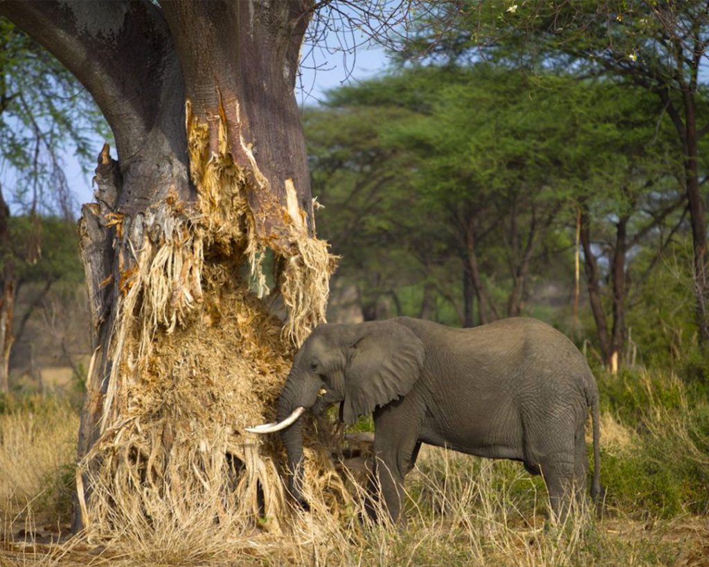
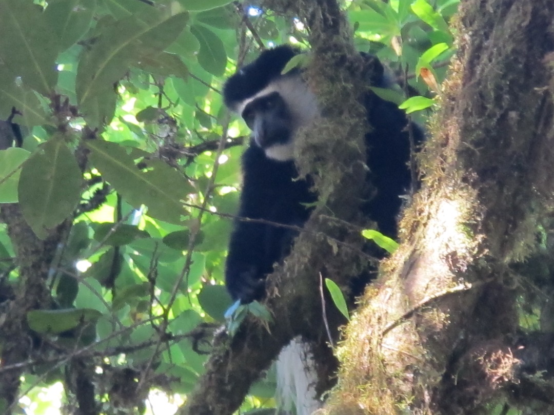
- 140 species of mammals
- 25 carnivores
- 25 antelopes
- 179 species of birds
- 24 species of bat
- Including black and white colobus monkey, blue monkey, forest duikers, myosorexzinkii (endemic
to Kilimanjaro), buffaloes, elands, elephants (large mammals seen at Shira plateau and Rongai)
Means of transport/access: accessible by road
Climate:
- Mainly influenced by the prevailing trade winds with 2 rain seasons
- Wet season in March to May and dry season in late June through September.
- Short rains in October – December.
- January – February it is dry, warm and clear with brief rain showers suitable for climbing
Best time to visit:
- It is accessible throughout the year but
- Best in mid-June to October and December to mid-March.
Tourism activities:
- Mountain climbing to the summit (5 to 8 days)
- Non-summit bound climbing
- Nature walking safaris
- Short walking safaris
- Long walking safaris
Mawenzi Technical climbing of the 7 sub-peaks
- Hans Meyer 5149
- Nordecke 5136
- Purtscheller 5120m
- Borchers 5115m
- Klute 5096m
- Latham 5087m
- Londt 4945m
- Picnicking (13 picnic sites)
- Filming
- Crater camping
- Mountain cycling (5 to 7 days to the summit with picnic sites and resting points, the world’s most
challenging mountain cycling and the world’s longest mountain downhill ride
Kilema route for summit bound cyclists
Shira route for non-summit cyclists
- Paragliding
Tourism facilities/services:
- 24 mountain huts capable to host 322 beds
- 21 operation camping sites
- Accommodation full capacity of 1,305 to 3,915
- Rescue wheel stretcher and ambulance